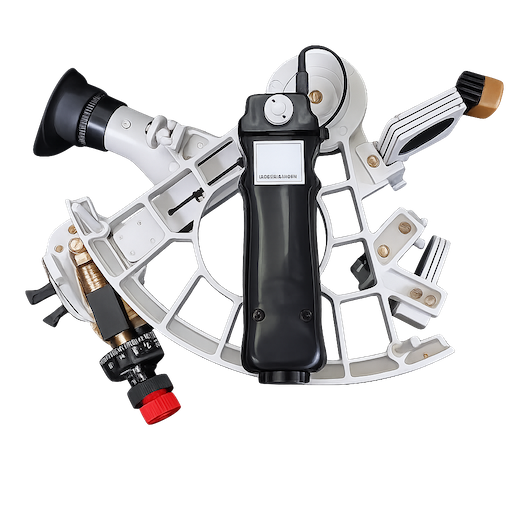
um den Faktor 10 gesteigert!
Wie allgemein bekannt ist, verfügt das GPS - Global Positioning System über zwei verschiedene Genauigkeitsgrade. Während sich die zivilen Benutzer, Luftfahrt, Seefahrt und Straßenverkehr mit einer Genauigkeit von praktisch(!) plusminus 200 Meter begnügen mussten, konnten die (amerikanischen) Militärs wegen der “Brisanz” des Einsatzzwecks ihre Raketen mit GPS-Hilfe auf wenige Meter genau “navigieren”. Diese hohe Genauigkeit wurde für den zivilen Gebrauch des GPS-Systems bis auf die bekannte Streuung reduziert. Diese sogenannte Selective Availability (SA) sollte schrittweise bis 2006 abgebaut werden.
Überraschend hat man nun in Washington ab sofort die Selective Availability (SA) gecancelt. Über die Gründe kann man letztlich nur Vermutungen anstellen. Sicher steht hierbei Menschenliebe nicht im Vordergrund. Einen Schub für diese Entwicklung haben Pläne zur Schaffung eines zivilen Systems gegeben. Denn sicher hätte man in Washington nicht gerne gehört, dass nunmehr das militärische GPS ausgedient, weil zu ungenau, hätte.
Die unmittelbare Konsequenz für den zivilen Benutzer, ob im Auto oder auf der Segelyacht, auch im Flugverkehr, besteht darin, dass die herkömmlichen Geräte eine Genauigkeit von ungefähr 10 Metern anzeigen. Dies müsste allerdings noch über einen gewissen Zeitraum kontrolliert werden, bis man sich darauf einigermassen verlassen kann. Allerdings wird sich für die Schiffahrt zunächst gar nichts ändern. Denn die Seekartentechnik wird dieser gesteigerten Genauigkeit gar nicht gewachsen sein, weil die (Papier-)Karten nicht so exakt sind, sein können. Aber immerhin, es wird eine interessante Spielerei sein, vorne am Anker eine andere Position zu messen wie am Steuerstand.
Die Differential-GPS-Geräte, solange sie sich des landgestützten Korrekturdienstes bedient haben, sind damit überflüssig geworden, weil eine Steigerung über die “militärische” Genauigkeit hinaus zwar denkbar, doch praktisch keinen Sinn mehr macht..
Diese neueste Entwicklung hat aber auch aufgezeigt, dass weiterhin bei der Benutzung des GPS Vorsicht geboten ist. Ein Schwachpunkt des heutigen (militärischen) GPS-Dienstes war nämlich immer schon die Manipulationsmöglichkeit des gesamten Systems durch die Militärs - bis zur örtlich begrenzten “Verungenauerung.” Zwar ist damit ohne Ansage nur im Krisenfall zu rechnen (und tatsächlich wurde davon auch noch nie Gebrauch gemacht, auch nicht im Irakkrieg), aber wer weiß das schon…
Was wenige realisieren: Das GPS kann auch zu Servicezwecken jederzeit abgeschalten werden. Dann hilft auch kein zweiter GPS-Empfänger an Bord. Nach wie vor gebietet es gute Seemannschaft, ein Ersatzsystem (Backupsystem) zur Ortsbestimmung an Bord zu haben, und es auch beherrschen zu können.
Nachfolgend die Erklärung von Präsident Clinton im Wortlaut:
THE WHITE HOUSE
Office of the Press Secretary
_________________________________________________________________________ For Immediate Release May 1, 2000
President Clinton: Improving the Civilian Global Positioning System (GPS)
May 1, 2000
“The decision to discontinue Selective Availability is the latest measure in an ongoing effort to make GPS more responsive to civil and commercial users worldwide…this increase in accuracy will allow new GPS applications to emerge and continue to enhance the lives of people around the world.” President Bill Clinton May 1, 2000
GPS IS A CRITICAL TECHNOLOGY FOR INDIVIDUALS AND BUSINESSES AROUND THE GLOBE. GPS is a dual-use system, providing highly accurate positioning and timing data for both military and civilian users. There are more than 4 million GPS users world wide, and the market for GPS applications is expected to double in the next three years, from $8 billion to over $16 billion. Some of these applications include: air, road, rail, and marine navigation, precision agriculture and mining, oil exploration, environmental research and management, telecommunications, electronic data transfer, construction, recreation and emergency response.
GPS IS THE GLOBAL STANDARD. GPS has always been the dominant standard satellite navigation thanks to the U.S. policy of making both the signal and the receiver design specification available to the public completely free of charge.
NEW TECHNOLOGIES ENHANCE AMERICA’S NATIONAL SECURITY. The U.S. previously employed a technique called Selective Availability (SA) to globally degrade the civilian GPS signal. New technologies demonstrated by the military enable the U.S. to degrade the GPS signal on a regional basis. GPS users worldwide would not be affected by regional, security-motivated, GPS degradations, and businesses reliant on GPS could continue to operate at peak efficiency.
GPS IMPROVED SIGNAL WILL BRING INSTANT BENEFITS TO MILLIONS OF GPS USERS. The improved, non-degraded signal will increase civilian accuracy by an order of magnitude, and have immediate implications in areas such as:
Car Navigation: Previously, a GPS-based car navigation could give the location of the vehicle to within a hundred meters. This was a problem, for example in areas where multiple highways run in parallel, because the degraded signal made it difficult to determine which one the car was on. Terminating SA will eliminate such problems, leading to greater consumer confidence in the technology and higher adoption rates. It will also simplify the design of many systems (e.g., eliminate certain map matching software), thereby lowering their retail cost.
Enhanced-911: The FCC will soon require that all new cellular phones be equipped with more accurate location determination technology to improve responses to emergency 911 calls. Removing SA will boost the accuracy of GPS to such a degree that it could become the method of choice for implementing the 911 requirement. A GPS-based solution might be simpler and more economical than alternative techniques such as radio tower triangulation, leading to lower consumer costs.
Hiking, Camping, and Hunting: GPS is already popular among outdoorsmen, but the degraded accuracy has not allowed them to precisely pin-point their location or the location of items (such as game) left behind for later recovery. With 20 meter accuracy or better, hikers, campers, and hunters should be able to navigate their way through unmarked wilderness terrain with increased confidence and safety. Moreover, users will find that the accuracy of GPS exceeds the resolution of U.S. Geological Survey (USGS) topographical quad maps.
Boating and Fishing: Recreational boaters will enjoy safer, more accurate navigation around sandbars, rocks, and other obstacles. Fishermen will be able to more precisely locate their favorite spot on a lake or river. Lobster fishermen will be able to find and recover their traps more quickly and efficiently.
Increased Adoption of GPS Time: In addition to more accurate position information, the accuracy of the time data broadcast by GPS will improve to within 40 billionths of a second. Such precision may encourage adoption of GPS as a preferred means of acquiring Universal Coordinated Time (UTC) and for synchronizing everything from electrical power grids and cellular phone towers to telecommunications networks and the Internet. For example, with higher precision timing, a company can stream more data through a fiber optic cable by tightening the space between data packets. Using GPS to accomplish this is far less costly than maintaining private atomic clock equipment.
Additional information about GPS and the Selective Availability decision is available online at the Interagency GPS Executive Board web site: http://www.igeb.gov
30-30-30